-
Faculty of Arts and HumanitiesDean's Office, Faculty of Arts and HumanitiesJakobi 2, r 116-121 51005 Tartu linn, Tartu linn, Tartumaa EST0Institute of History and ArchaeologyJakobi 2 51005 Tartu linn, Tartu linn, Tartumaa EST0Institute of Estonian and General LinguisticsJakobi 2, IV korrus 51005 Tartu linn, Tartu linn, Tartumaa EST0Institute of Philosophy and SemioticsJakobi 2, III korrus, ruumid 302-337 51005 Tartu linn, Tartu linn, Tartumaa EST0Institute of Cultural ResearchÜlikooli 16 51003 Tartu linn, Tartu linn, Tartumaa EST0Institute of Foreign Languages and CulturesLossi 3 51003 Tartu linn, Tartu linn, Tartumaa EST0School of Theology and Religious StudiesÜlikooli 18 50090 Tartu linn, Tartu linn, Tartumaa EST0Viljandi Culture AcademyPosti 1 71004 Viljandi linn, Viljandimaa EST0Professors emeriti, Faculty of Arts and Humanities0Associate Professors emeriti, Faculty of Arts and Humanities0Faculty of Social SciencesDean's Office, Faculty of Social SciencesLossi 36 51003 Tartu linn, Tartu linn, Tartumaa EST0Institute of EducationJakobi 5 51005 Tartu linn, Tartu linn, Tartumaa EST0Johan Skytte Institute of Political StudiesLossi 36, ruum 301 51003 Tartu linn, Tartu linn, Tartumaa EST0School of Economics and Business AdministrationNarva mnt 18 51009 Tartu linn, Tartu linn, Tartumaa EST0Institute of PsychologyNäituse 2 50409 Tartu linn, Tartu linn, Tartumaa EST0School of LawNäituse 20 - 324 50409 Tartu linn, Tartu linn, Tartumaa EST0Institute of Social StudiesLossi 36 51003 Tartu linn, Tartu linn, Tartumaa EST0Narva CollegeRaekoja plats 2 20307 Narva linn, Ida-Virumaa EST0Pärnu CollegeRingi 35 80012 Pärnu linn, Pärnu linn, Pärnumaa EST0Professors emeriti, Faculty of Social Sciences0Associate Professors emeriti, Faculty of Social Sciences0Faculty of MedicineDean's Office, Faculty of MedicineRavila 19 50411 Tartu linn, Tartu linn, Tartumaa ESTInstitute of Biomedicine and Translational MedicineBiomeedikum, Ravila 19 50411 Tartu linn, Tartu linn, Tartumaa ESTInstitute of PharmacyNooruse 1 50411 Tartu linn, Tartu linn, Tartumaa ESTInstitute of DentistryL. Puusepa 1a 50406 Tartu linn, Tartu linn, Tartumaa ESTInstitute of Clinical MedicineL. Puusepa 8 50406 Tartu linn, Tartu linn, Tartumaa ESTInstitute of Family Medicine and Public HealthRavila 19 50411 Tartu linn, Tartu linn, Tartumaa ESTInstitute of Sport Sciences and PhysiotherapyUjula 4 51008 Tartu linn, Tartu linn, Tartumaa ESTProfessors emeriti, Faculty of Medicine0Associate Professors emeriti, Faculty of Medicine0Faculty of Science and TechnologyDean's Office, Faculty of Science and TechnologyVanemuise 46 - 208 51003 Tartu linn, Tartu linn, Tartumaa ESTInstitute of Computer ScienceNarva mnt 18 51009 Tartu linn, Tartu linn, Tartumaa ESTInstitute of GenomicsRiia 23b/2 51010 Tartu linn, Tartu linn, Tartumaa ESTEstonian Marine Institute0Institute of PhysicsInstitute of ChemistryRavila 14a 50411 Tartu linn, Tartu linn, Tartumaa EST0Institute of Mathematics and StatisticsNarva mnt 18 51009 Tartu linn, Tartu linn, Tartumaa EST0Institute of Molecular and Cell BiologyRiia 23, 23b - 134 51010 Tartu linn, Tartu linn, Tartumaa ESTTartu ObservatoryObservatooriumi 1 61602 Tõravere alevik, Nõo vald, Tartumaa EST0Institute of TechnologyNooruse 1 50411 Tartu linn, Tartu linn, Tartumaa ESTInstitute of Ecology and Earth SciencesJ. Liivi tn 2 50409 Tartu linn, Tartu linn, Tartumaa ESTProfessors emeriti, Faculty of Science and Technology0Associate Professors emeriti, Faculty of Science and Technology0Institute of BioengineeringArea of Academic SecretaryHuman Resources OfficeUppsala 6, Lossi 36 51003 Tartu linn, Tartu linn, Tartumaa EST0Area of Head of FinanceFinance Office0Area of Director of AdministrationInformation Technology Office0Administrative OfficeÜlikooli 17 (III korrus) 51005 Tartu linn, Tartu linn, Tartumaa EST0Estates Office0Marketing and Communication OfficeÜlikooli 18, ruumid 102, 104, 209, 210 50090 Tartu linn, Tartu linn, Tartumaa EST0Area of RectorRector's Strategy OfficeInternal Audit OfficeArea of Vice Rector for Academic AffairsOffice of Academic AffairsUniversity of Tartu Youth AcademyUppsala 10 51003 Tartu linn, Tartu linn, Tartumaa EST0Student Union OfficeÜlikooli 18b 51005 Tartu linn, Tartu linn, Tartumaa EST0Centre for Learning and TeachingArea of Vice Rector for ResearchUniversity of Tartu LibraryW. Struve 1 50091 Tartu linn, Tartu linn, Tartumaa EST0Grant OfficeArea of Vice Rector for DevelopmentCentre for Entrepreneurship and InnovationNarva mnt 18 51009 Tartu linn, Tartu linn, Tartumaa EST0University of Tartu Natural History Museum and Botanical GardenVanemuise 46 51003 Tartu linn, Tartu linn, Tartumaa EST0International Cooperation and Protocol Office0University of Tartu MuseumLossi 25 51003 Tartu linn, Tartu linn, Tartumaa EST0
Chair of Geoinformatics and Cartography
MISSION
The Chair of Geoinformatics and Cartography provides education and carries out research in geomatics, geoinformatics, cartography as well as remote sensing, geodesy and topography. The chair provides support in tasks related to geoinformatics and cartography to other chairs in the department and the institute.
EDUCATION
Specialization in geoinformatics and cartography is suitable for students interested in the understanding and application of spatial knowledge: maps, geographic information systems (GIS), geospatial modelling, analysis and programming. Graduates will find employment in IT and mapping companies, land surveying offices, governmental institutions, local governments or private companies looking for GIS specialists, cartographers and spatial data analysts/scientists. Since there is a growing demand for people with an advanced skillset in geoinformatics in many disciplines, the chair is also tasked with developing spatial skills of both human and physical geographers as well as students from “non-spatial” disciplines.
RESEARCH
The purpose of our research is to analyze and develop different uses of geospatial data, spatial understanding, and their applications in the areas of natural and human environments alike. Through applied scientific research projects, the chair is directly involved in developing solutions for problems in the scope of the state and local governments. The chair also carries out ongoing research related to the history of Estonian cartography started by Professor Endel Varep.
At the Chair of Geoinformatics and Cartographyhave we have several focused research labs and work groups, including:
- Landscape Geoinformatics
- Remote Sensing
RESEARCH TOPICS
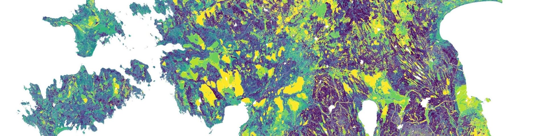
- The use of landscape metrics in describing and relating spatial patterns to ecological, physical and social phenomena; the effect of urbanization on spatial patterns; analysis of the reliability and the uncertainty of the landscape metrics
- Applications in remote sensing, including research related to the applicability and quality assessment of UAV photogrammetry
- Analysis of global land use and topography changes
- Development of predictive mapping and lazy learning methods
- Research in the field of the reliability, usability and accuracy of maps
- Development of web-based spatial data applications
- Research on improving the teaching methods of geography and geoinformatics
BSc and MSc theses can be conducted on these topics.
COLLABORATION
Research done by the chair is carried out as the Lab of Geoinformatics and Cartography. The Lab of Geoinformatics and Cartography is a member of the Association of Geographic Information Laboratories in Europe (AGILE).
Under initiative of the Department of Geography, the University of Tartu (UT) has joined the Open Geospatial Consortium (OGC) in order to further strengthen its leading role in providing geospatial education and innovation. The membership enables all UT researchers, staff and students to actively participate in international standards working groups and provide real input to the development of standards that shape the geospatial and big data industry.
The Department of Geography puts strong emphasis on co-operation and partnerships between academic and professional GIS practitioners across disciplines. This is also reflected in the various established spin-off companies that specialize in geospatial data management, analysis and application development. We are actively collaborating with the Estonian Land Board, geospatial companies like Regio, and Reach-U, the Estonian Geoinformatics Society (ESTGIS) and Tartu City Government.
PROJECTS
Ongoing projects
- RITA program project “Using remote monitoring data for the development of public services”. Head of the consortium is Anu Reinart from the Tartu Observatory; partners are University of Tartu, TalTech, Estonian University of Life Sciences and KappaZeta OÜ. We study ways of preventing and suppressing wildfires (responsible partner is Tõnu Oja from our chair), monitoring the use of agricultural land, monitoring floods and water levels and supervision of construction activities.
- Post-doctoral research project, Alexander Kmoch: Using data fusion and data assimilation methods and advancing computational parallelization for hydrological modelling; and estimating sensitivity to spatial of SWAT parameterization (via various input datasets, DEM, soil, land cover) to model nitrogen and phosphorus runoff at local and global scale.
- Post-doctoral research project, Merle Muru: “Coastal Change: modelling submerged landscapes and prehistoric human colonisation of the southern North Sea basin”.